
Favourite
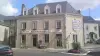
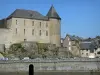
Mayenne
| Municipality | Martigné-sur-Mayenne |
|---|---|
| Postcode | 53470 |
| Latitude | 48.1944770 (N 48° 11’ 40”) |
| Longitude | -0.6650620 (W 0° 39’ 54”) |
| Altitude | From 72m to 165m |
| Surface area | 31.61 km² |
| Population | 1938 inhabitants |
| Density | 61 inhabitants/km² |
| Prefecture | Laval (21 km, 23 min) |
| Insee code | 53146 |
| Intercommunality | CC Mayenne Communauté |
| Department | Mayenne |
| Territory | Maine |
| Region | Pays de la Loire |
| Châlons-du-Maine | 4.4 km (8 min) |
|---|---|
| Sacé | 4.5 km (9 min) |
| La Bazouge-des-Alleux | 4.5 km (6 min) |
| Montflours | 6.8 km (12 min) |
| Commer | 7.2 km (10 min) |
| Saint-Germain-d'Anxure | 8.5 km (13 min) |
| Alexain | 9.2 km (11 min) |
| Louverné | 9.6 km (8 min) |
| Moulay | 9.9 km (9 min) |
| Gesnes | 10.8 km (13 min) |
| Saint-Baudelle | 11.5 km (13 min) |
| Montsûrs | 11.8 km (14 min) |
| La Chapelle-Anthenaise | 12.3 km (12 min) |
| Placé | 12.4 km (13 min) |

| Last name | Activity type | Rate | City |
|---|---|---|---|
 | Well-being | 60 € to 150 € | Bagnoles de l'Orne Normandie (44 km) |
| Last name | Outing type | Difficulty | Duration | Departure municipality |
|---|---|---|---|---|
 | Cycling itinerary | Intermediate | 5:00 | Soucé (30 km) |
 | Village visit | Easy | 2:00 | La Roche-Neuville (33 km) |
 | Hike | Easy | 1:45 | Prée-d'Anjou (40 km) |
 | Car itinerary | Easy | 4:00 | Saint-Cyr-du-Bailleul (42 km) |
 | Hike | Easy | 3:00 | Saint-Denis-d'Anjou (48 km) |