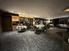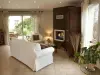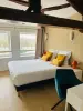

Favourite
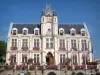
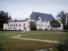
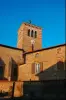
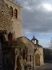
Montrond-les-Bains
| Municipality | Saint-Cyr-les-Vignes |
|---|---|
| Postcode | 42210 |
| Tourism label | ") |
| Latitude | 45.6762320 (N 45° 40’ 34”) |
| Longitude | 4.2993880 (E 4° 17’ 58”) |
| Altitude | From 357m to 595m |
| Surface area | 19.38 km² |
| Population | 1077 inhabitants |
| Density | 55 inhabitants/km² |
| Prefecture | Saint-Etienne (41 km, 40 min) |
| Insee code | 42214 |
| Intercommunality | CC de Forez-Est |
| Department | Loire |
| Territories | Lyonnais, Massif Central |
| Region | Auvergne-Rhône-Alps |
| Valeille | 4.3 km (6 min) |
|---|---|
| Bellegarde-en-Forez | 4.5 km (9 min) |
| Saint-André-le-Puy | 5.5 km (8 min) |
| Salt-en-Donzy | 7.2 km (9 min) |
| Montrond-les-Bains | 8 km (13 min) |
| Marclopt | 8.4 km (17 min) |
| Jas | 9.6 km (14 min) |
| Virigneux | 10 km (16 min) |
| Saint-Laurent-la-Conche | 10.3 km (18 min) |
| Cuzieu | 10.5 km (17 min) |
| Saint-Galmier | 11 km (15 min) |
| Salvizinet | 11.3 km (15 min) |
| Feurs | 11.5 km (13 min) |
| Saint-Barthélemy-Lestra | 11.6 km (12 min) |
| Boisset-lès-Montrond | 12.2 km (18 min) |
| Last name | Activity type | Rate | City |
|---|---|---|---|
 | Culture and education | 4 € to 6 € | Bussières (18 km) |
 | Sports sensations | 30 € to 40 € | Bessenay (24 km) |
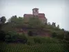
 | Nature and the great outdoors | 50 € to 220 € | Chamelet (36 km) |
 | Culture and education | 9 € | Lyon (41 km) |
 | Entertainment | 36 € | Lyon (41 km) |
| Last name | Outing type | Difficulty | Duration | Departure municipality |
|---|---|---|---|---|
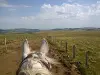
 | Hike | Easy | 1:40 | Montrottier (18.2 km) |
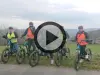
 | Mountain bike itinerary | Athletic | 1:25 | Montbrison (20 km) |
 | Hike | Intermediate | 3:05 | Lézigneux (22 km) |
 | Village visit | Intermediate | 1:00 | Saint-Bonnet-le-Courreau (28 km) |
 | Hike | Intermediate | 3:25 | Saint-Anthème (35 km) |