August 15 large flea market.

Favourite


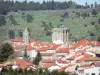
| Municipality | Saint-Préjet-d'Allier |
|---|---|
| Postcode | 43580 |
| Tourism label | ") |
| Latitude | 44.9156400 (N 44° 54’ 56”) |
| Longitude | 3.6225240 (E 3° 37’ 21”) |
| Altitude | From 711m to 1135m |
| Surface area | 24.46 km² |
| Population | 178 inhabitants |
| Density | 7 inhabitants/km² |
| Prefecture | Le Puy-en-Velay (37 km, 39 min) |
| Insee code | 43220 |
| Intercommunality | CA du Puy-en-Velay |
| Department | Haute-Loire |
| Territories | Auvergne, Massif Central |
| Region | Auvergne-Rhône-Alps |
| Monistrol-d'Allier | 8.5 km (12 min) |
|---|---|
| Saint-Vénérand | 8.9 km (15 min) |
| Bel-Air-Val-d'Ance | 10.1 km (17 min) |
| Alleyras | 10.3 km (16 min) |
| Thoras | 11 km (20 min) |
| Saugues | 11.4 km (16 min) |
| Saint-Christophe-d'Allier | 13.1 km (21 min) |
| Saint-Privat-d'Allier | 13.4 km (17 min) |
| Esplantas-Vazeilles | 13.4 km (19 min) |
| Venteuges | 16.9 km (26 min) |
| Ouides | 18.4 km (28 min) |
| Grèzes | 18.5 km (27 min) |
| Saint-Jean-Lachalm | 18.6 km (27 min) |
| Prades | 18.9 km (28 min) |
| Cubelles | 19 km (30 min) |
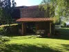
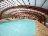
| Leisure centres |
|---|
August 15 large flea market.


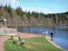
At 25 km, near Cayres : Lake Bouchet, of volcanic origin.
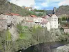
deserted medieval village of Montchauvet to Saugues (near Servières).
| Last name | Activity type | Rate | City |
|---|---|---|---|
 | Sports sensations | 50 € to 60 € | Vieille-Brioude (44 km) |
| Last name | Outing type | Difficulty | Duration | Departure municipality |
|---|---|---|---|---|
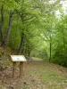
 | Hike | Easy | 1:30 | Cayres (13.8 km) |
 | Hike | Easy | 2:00 | Cayres (13.8 km) |
 | Hike | Easy | 2:30 | Cayres (14.5 km) |
 | Hike | Intermediate | 4:00 | Cayres (14.7 km) |
 | Hike | Easy | 25 min | Aiguilhe (25 km) |