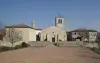
The common Sury-le-Comtal is located in the department of the Loire, at the intersection of Plain and Mountains Forez, 20 km northwest of Saint-Etienne and 10km southeast of Montbrison. It is built on a rectangular plate along the river "La Mare". With a rich history found in the remains found dating from the Gallo-Roman.
The etymology of Sury-le-Comtal comes from "Surius" Latin name of man and "count" designating a village directly submitted to a count.
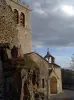
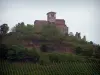
The village of Sury developed from the 11th century around a medieval castle. In the 11th and 12th century has created a wall demarcating the right. In the 12th century the town expands and grows around the castle in a semi-concentric and is continuing its expansion south into the "new town" and is organized on a regular plan and orthogonal. In the 14th century a second fort was built. In the 19th century a semi-industrial development moved around the axis of movement to the east and south.
In the 20th century urbanization develops east of the town. It is characterized by a low density suburban housing, a number of family housing, new school facilities, sports ... distributed throughout the territory. The remains of the different speakers, doors, towers etc.. thus allow to understand the evolution of the town from its origins and contain elements of historical and cultural remarkable.
")