


Favourite
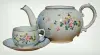
Lorraine faience pottery
| Municipality | Valmont |
|---|---|
| Postcode | 57730 |
| Tourism label | ") |
| Latitude | 49.0835130 (N 49° 5’ 1”) |
| Longitude | 6.6978450 (E 6° 41’ 52”) |
| Altitude | From 246m to 387m |
| Surface area | 9.24 km² |
| Population | 3044 inhabitants |
| Density | 329 inhabitants/km² |
| Prefecture | Metz (52 km, 41 min) |
| Insee code | 57690 |
| Intercommunality | CA Saint-Avold Synergie |
| Department | Moselle |
| Territory | Lorraine |
| Region | Great East |
| Folschviller | 2.1 km (5 min) |
|---|---|
| Saint-Avold | 3.8 km (8 min) |
| Teting-sur-Nied | 3.9 km (7 min) |
| Altviller | 5.6 km (9 min) |
| Lelling | 6.3 km (10 min) |
| Lachambre | 6.4 km (9 min) |
| Macheren | 7 km (11 min) |
| Pontpierre | 7.6 km (11 min) |
| Longeville-lès-Saint-Avold | 7.8 km (8 min) |
| Laudrefang | 8 km (13 min) |
| Vahl-Ebersing | 8.6 km (10 min) |
| Hombourg-Haut | 8.7 km (11 min) |
| Guenviller | 10 km (14 min) |
| Lixing-lès-Saint-Avold | 10.1 km (11 min) |
| Faulquemont | 10.3 km (13 min) |
| Transport |
|---|
| Last name | Outing type | Difficulty | Duration | Departure municipality |
|---|---|---|---|---|
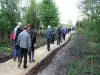 | Hike | Easy | 30 min | Ham-sous-Varsberg (11.4 km) |
 | Hike | Easy | 2:00 | Berviller-en-Moselle (21 km) |
 | Cycling itinerary | Easy | 4:30 | Frauenberg (32 km) |
| Cycling itinerary | Easy | 4:00 | Lorentzen (38 km) |
| Hike | Easy | 2:00 | Diemeringen (39 km) |