Small easy walk with a low gradient (rising Verdier) on a path of earth and stones. You can contemplate the valley of Saint-Julien in Capdenac High, from the Cross of Verdier. Thank you to respect nature. Good ride!
Figeac
Small easy walk with a low gradient (rising Verdier) on a path of earth and stones. You can contemplate the valley of Saint-Julien in Capdenac High, from the Cross of Verdier. Thank you to respect nature. Good ride!

| Department | Aveyron |
|---|---|
| Departure municipality | Capdenac-Gare |
| Outing type | Hike |
| Difficulty | Easy |
| Duration | 1:30 |
| Recommended period | from january to december |
| Environment | Countryside |
| Kilometres | 4 km |
| Altitude upon departure | 200m |
| Change in altitude | 50m |
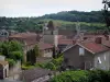
From the city center Capdenac-Gare, go to the banks of the batch, direction Villefranche-de-Rouergue.
At the roundabout Intermarché follow Villefranche-de-Rouergue, ditto the 2nd roundabout in Saint-Julien Empare.
After 200 m turn right Malepeyre (possibility to park at the top of the village).
In the village take the dirt road that runs along the creek.
Departure from the hamlet of Malepeyre. Opposite the house with timber, take one dirt road, pass the waterfall, right drive for 200 meters, at the junction to the left to the rocky overhang (note the empty!). Continue on the trail to the road. Take a right on 300 m, turn right at the crossroads, Le Verdier.
Through the hamlet, direction La Croix du Verdier (path in the box).
You are halfway through, take the time to relax!
Continue on the same path (only one) to the village of Saint-Julien Empare.
At the road, turn right on 200 m, take the first right (small road) for 200 m.
Garage, left, small road of earth and stones, follow the trail to find the way out.
On the left, you arrived at Malepeyre.