This short and varied walk offers beautiful views over the mountains around Mélagues. Walk up along the GR 71, past Cayourtes and Planquettes Farms to Mélagues along the path which children once used to get to school.
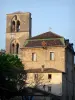
Sylvanès Abbey


This short and varied walk offers beautiful views over the mountains around Mélagues. Walk up along the GR 71, past Cayourtes and Planquettes Farms to Mélagues along the path which children once used to get to school.

| Department | Aveyron |
|---|---|
| Departure municipality | Mélagues |
| Outing type | Hike |
| Difficulty | Easy |
| Duration | 2:00 |
| Recommended period | from january to december |
| Environment | Mountains |
| Kilometres | 5 km |
| Altitude upon departure | 685m |
| Change in altitude | 221m |
Depart from Mélagues town hall, in the centre.
Depart from Mélagues town hall.
Follow the D52 northwest and turn right after the Virgin. Continue along the GR 71, red/white signposting. At the end of the village, turn left.
Continue along this path, called the 'la Caral', for about 2 km; halfway, stop and admire the iron cross on your left.
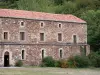
At the fork in the road, turn right and leave the GR. Leave the houses of Cayourtes on your left and continue on your way. Cross the Cayourtes Ravine and the Fragues Stream.
After about 2 km, you will arrive at Les Planquettes-Hautes; at the fork in the road, turn right. At Les Planquettes, turn right and pass through the small hamlet. Follow the yellow signs down to Mélagues. As soon you see the small stream, follow it and continue along the schoolchildren's path.
Join the GR 71, turn left and return to Mélagues Town Hall.