
Favourite
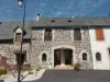
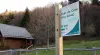
Riom-ès-Montagnes


| Municipality | Apchon |
|---|---|
| Postcode | 15400 |
| Latitude | 45.2466020 (N 45° 14’ 48”) |
| Longitude | 2.6929520 (E 2° 41’ 35”) |
| Altitude | From 833m to 1143m |
| Surface area | 12.43 km² |
| Population | 190 inhabitants |
| Density | 15 inhabitants/km² |
| Prefecture | Aurillac (59 km, 1:02) |
| Insee code | 15009 |
| Intercommunality | CC du Pays Gentiane |
| Department | Cantal |
| Territories | Auvergne, Massif Central |
| Region | Auvergne-Rhône-Alps |
| Saint-Hippolyte | 3 km (4 min) |
|---|---|
| Cheylade | 5.4 km (8 min) |
| Collandres | 5.9 km (9 min) |
| Riom-ès-Montagnes | 6 km (9 min) |
| Marchastel | 7.6 km (16 min) |
| Le Claux | 11.2 km (16 min) |
| Valette | 11.9 km (18 min) |
| Lugarde | 12.2 km (19 min) |
| Ségur-les-Villas | 12.9 km (15 min) |
| Menet | 13 km (20 min) |
| Saint-Saturnin | 13.5 km (18 min) |
| Saint-Amandin | 15.9 km (19 min) |
| Saint-Bonnet-de-Condat | 17.1 km (22 min) |
| La Monselie | 17.1 km (26 min) |
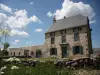
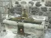
| Monuments |
|---|
| Last name | Activity type | Rate | City |
|---|---|---|---|
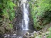
 | Nature and the great outdoors | 40 € to 75 € | Albepierre-Bredons (22 km) |
 | Sports sensations | 20 € | Lanobre (26 km) |
 | Sports sensations | 50 € to 350 € | Coltines (30 km) |
| Last name | Outing type | Difficulty | Duration | Departure municipality |
|---|---|---|---|---|
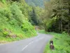
 | Hike | Intermediate | 3:05 | Saint-Jacques-des-Blats (18.2 km) |
 | Hike | Intermediate | 2:30 | Saint-Genès-Champespe (19.3 km) |
 | Village visit | Easy | 1:00 | Fontanges (21 km) |
 | Cycling itinerary | Intermediate | 40 min | Picherande (27 km) |
 | Hike | Intermediate | 2:00 | Veyrières (27 km) |