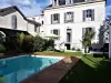
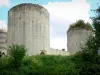
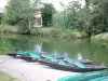
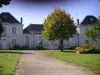
Located between Niort and Saint-Maixent-l'Ecole, Cherveux is easily accessible from the A83 exit 10.


Favourite


Located between Niort and Saint-Maixent-l'Ecole, Cherveux is easily accessible from the A83 exit 10.
| Municipality | Cherveux |
|---|---|
| Postcode | 79410 |
| Latitude | 46.4155840 (N 46° 24’ 56”) |
| Longitude | -0.3559330 (W 0° 21’ 21”) |
| Altitude | From 46m to 116m |
| Surface area | 22.25 km² |
| Population | 1975 inhabitants |
| Density | 88 inhabitants/km² |
| Prefecture | Niort (17.7 km, 22 min) |
| Insee code | 79086 |
| Intercommunality | CC Haut Val de Sèvre |
| Department | Deux-Sèvres |
| Territory | Poitou |
| Region | New-Aquitaine |
| Saint-Christophe-sur-Roc | 5.2 km (8 min) |
|---|---|
| Saint-Gelais | 5.2 km (7 min) |
| François | 5.6 km (7 min) |
| Échiré | 7 km (11 min) |
| Augé | 7.8 km (11 min) |
| Germond-Rouvre | 8.1 km (12 min) |
| Chauray | 8.4 km (12 min) |
| La Crèche | 8.4 km (12 min) |
| La Chapelle-Bâton | 8.5 km (13 min) |
| Champdeniers | 9.7 km (10 min) |
| Azay-le-Brûlé | 10.5 km (14 min) |
| Sainte-Ouenne | 11.7 km (17 min) |
| Surin | 12.2 km (19 min) |
| Sainte-Néomaye | 12.4 km (17 min) |
| Last name | Outing type | Difficulty | Duration | Departure municipality |
|---|---|---|---|---|
 | Hike | Intermediate | 3:45 | Saint-Michel-le-Cloucq (31 km) |
 | Hike | Easy | 1:05 | Le Gué-de-Velluire (44 km) |
 | Hike | Easy | 1:05 | La Taillée (44 km) |
 | Hike | Easy | 1:00 | La Taillée (44 km) |
 | Hike | Easy | 3:45 | Puyrolland (49 km) |