Liven up your holidays!

Lettret

Tourism, holidays & weekends guide in the Hautes-Alpes

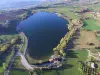
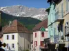
Located between the shimmering waters of the Durance and a steep cliff with dark schist walls, the commune of Lettret takes, according to some, its name from its unique geographical location, marked by the narrowness of its territory (in old French: Lettroit). Lettret formerly formed only one and the same commune with Tallard-le-Vieux, from which it took its independence.

Geographical information

MunicipalityLettret
Postcode05130
Latitude44.4682710 (N 44° 28’ 6”)
Longitude6.0612950 (E 6° 3’ 41”)
AltitudeFrom 591m to 960m
Surface area4.20 km²
Population201 inhabitants
Density47 inhabitants/km²
PrefectureGap (14 km, 18 min)
Insee code05074
IntercommunalityCA Gap-Tallard-Durance
DepartmentHautes-Alpes
TerritoriesAlps, Dauphiné
RegionProvence-Alps-French Riviera

Nearest cities & towns

Châteauvieux5.7 km (11 min)
Curbans6.6 km (10 min)
La Saulce6.8 km (10 min)
Valserres6.9 km (9 min)
Fouillouse7 km (12 min)
Neffes9.2 km (13 min)
Remollon9.3 km (8 min)
Saint-Étienne-le-Laus10.1 km (10 min)
Jarjayes10.2 km (13 min)
Piégut10.5 km (14 min)
Rochebrune11.4 km (16 min)
Pelleautier11.8 km (18 min)
Sigoyer11.9 km (20 min)
Théus12.3 km (15 min)

Things to see and do

In addition to the Saint-Vincent de Paul church which sits in the heart of the village, Lettret houses, on the banks of the Durance, the ruins of the Notre-Dame-de-Rives chapel, whose destruction tradition attributes to the Saracens. You have to imagine, closing your eyes, the vanished beauty of this monument in the purest Romanesque style, probably dating from the 12th century. The only barrel-vaulted nave with a semicircular choir was pierced by a semicircular window, small and narrow, which provided daylight.

Weather

Monday 27 may
Min. 11°C - Max. 15°C
Day
Night
Tuesday 28 may
Min. 7°C - Max. 19°C
Day
Night
Wednesday 29 may
Min. 9°C - Max. 18°C
Day
Night

Visits, leisure and activities nearby

Leisure activities

Last nameActivity typeRateCity
Hot air balloon flight over the Champsaur Valley
Nature and the great outdoors200 € to 1100 € Ancelle (21 km)
Canyoning in the Ubaye Valley
Sports sensations44 € Ubaye-Serre-Ponçon (23 km)
Packraft on the Ubaye
Sports sensations85 € to 115 € Ubaye-Serre-Ponçon (26 km)
Rafting or hydrospeed down the Ubaye
Sports sensations45 € to 85 € Le Lauzet-Ubaye (29 km)
Visit a saffron and red fruit farm
Local flavoursFreeNoyers-sur-Jabron (40 km)

Outings

Last nameOuting typeDifficultyDurationDeparture municipality
Notre-Dame du Laus
HikeIntermediate5:00La Bâtie-Vieille (12.4 km)
La Bâtie-Vieille - Rambaud
HikeEasy3:00La Bâtie-Vieille (12.4 km)
Tour of Moissière
HikeEasy2:30Ancelle (19.3 km)
The white bridge trail
HikeEasy3:00Saint-Laurent-du-Cros (19.8 km)
The Arche and the Aiguille
HikeAthletic3:00Ancelle (21 km)

Restaurants

Bed & breakfasts

Vacation rentals

Campsites

Hotels

Your holidays
A hotel
A vacation rental
A bed & breakfast
A campsite
A leisure activity
A restaurant
A rental car
A plane ticket
By continuing to browse our site, you are agreeing to the use of cookies to improve your experience and make targeted offers.
Find out more and make settings
Your account