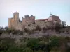
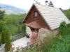
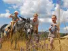
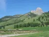
Municipality located at the foot of Céüse, place known for its climbing, hilltop villages and Mediterranean climate.
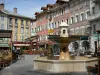
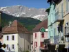
Picturesque village located 6 km from Gap.
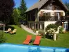
Municipality located at the foot of Céüse, place known for its climbing, hilltop villages and Mediterranean climate.
Picturesque village located 6 km from Gap.
| Municipality | Neffes |
|---|---|
| Postcode | 05000 |
| Latitude | 44.5047690 (N 44° 30’ 17”) |
| Longitude | 6.0229080 (E 6° 1’ 22”) |
| Altitude | From 633m to 892m |
| Surface area | 8.36 km² |
| Population | 796 inhabitants |
| Density | 95 inhabitants/km² |
| Prefecture | Gap (9.2 km, 13 min) |
| Insee code | 05092 |
| Intercommunality | CA Gap-Tallard-Durance |
| Department | Hautes-Alpes |
| Territories | Alps, Dauphiné |
| Region | Provence-Alps-French Riviera |
| Pelleautier | 2.7 km (6 min) |
|---|---|
| Tallard | 8.3 km (11 min) |
| La Freissinouse | 8.3 km (15 min) |
| Gap | 9.1 km (15 min) |
| Lettret | 9.2 km (13 min) |
| Sigoyer | 9.9 km (17 min) |
| Manteyer | 10 km (15 min) |
| Fouillouse | 10 km (14 min) |
| Châteauvieux | 10.2 km (17 min) |
| La Saulce | 10.6 km (14 min) |
| La Roche-des-Arnauds | 11.2 km (14 min) |
| Rabou | 13.5 km (23 min) |
| Rambaud | 14 km (23 min) |
| Curbans | 14.7 km (19 min) |
| Last name | Activity type | Rate | City |
|---|---|---|---|
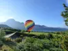
 | Nature and the great outdoors | 200 € to 1100 € | Ancelle (19.6 km) |
 | Sports sensations | 44 € | Ubaye-Serre-Ponçon (27 km) |
 | Sports sensations | 85 € to 115 € | Ubaye-Serre-Ponçon (29 km) |
 | Sports sensations | 45 € to 85 € | Le Lauzet-Ubaye (33 km) |
 | Nature and the great outdoors | 50 € to 375 € | Éourres (42 km) |
| Last name | Outing type | Difficulty | Duration | Departure municipality |
|---|---|---|---|---|
 | Hike | Intermediate | 5:00 | La Bâtie-Vieille (12.3 km) |
 | Hike | Easy | 3:00 | La Bâtie-Vieille (12.3 km) |
 | Hike | Easy | 3:00 | Saint-Laurent-du-Cros (16.9 km) |
 | Hike | Easy | 2:30 | Ancelle (18.9 km) |
 | Hike | Athletic | 3:00 | Ancelle (19.6 km) |