Favourite
Gap
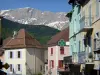
| Municipality | Manteyer |
|---|---|
| Postcode | 05400 |
| Latitude | 44.5381260 (N 44° 32’ 17”) |
| Longitude | 5.9644820 (E 5° 57’ 52”) |
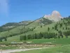
| Altitude | From 890m to 1974m |
| Surface area | 25.63 km² |
| Population | 465 inhabitants |
| Density | 18 inhabitants/km² |
| Prefecture | Gap (12.5 km, 14 min) |
| Insee code | 05075 |
| Intercommunality | CC Buëch-Dévoluy |
| Department | Hautes-Alpes |
| Territories | Alps, Dauphiné |
| Region | Provence-Alps-French Riviera |
| La Freissinouse | 3.8 km (7 min) |
|---|---|
| La Roche-des-Arnauds | 3.9 km (7 min) |
| Pelleautier | 8.4 km (12 min) |
| Neffes | 10 km (15 min) |
| Montmaur | 10.5 km (13 min) |
| Rabou | 13 km (20 min) |
| Gap | 13.2 km (19 min) |
| Sigoyer | 14.8 km (20 min) |
| Veynes | 15.7 km (18 min) |
| Furmeyer | 16.1 km (23 min) |
| Tallard | 18.2 km (25 min) |
| Rambaud | 18.8 km (27 min) |
| Châteauneuf-d'Oze | 19.2 km (24 min) |
| Oze | 19.8 km (27 min) |
| Leisure centres | |
|---|---|
| Natural sites |
| Last name | Activity type | Rate | City |
|---|---|---|---|
 | Nature and the great outdoors | 200 € to 1100 € | Ancelle (21 km) |
 | Sports sensations | 44 € | Ubaye-Serre-Ponçon (33 km) |
 | Sports sensations | 85 € to 115 € | Ubaye-Serre-Ponçon (35 km) |
 | Sports sensations | 45 € to 85 € | Le Lauzet-Ubaye (39 km) |
 | Nature and the great outdoors | 50 € to 375 € | Éourres (42 km) |
| Last name | Outing type | Difficulty | Duration | Departure municipality |
|---|---|---|---|---|
 | Hike | Easy | 3:00 | La Bâtie-Vieille (15.8 km) |
 | Hike | Intermediate | 5:00 | La Bâtie-Vieille (15.8 km) |
 | Hike | Easy | 3:00 | Saint-Laurent-du-Cros (16.4 km) |
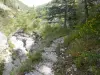 | Hike | Intermediate | 2:15 | La Faurie (18.2 km) |
 | Hike | Athletic | 3:00 | Ancelle (21 km) |