Liven up your holidays!

Sassenage

Tourism, holidays & weekends guide in the Isère

Sassenage - Tourism, holidays & weekends guide in the Isère
8.0
2

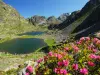
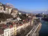
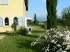
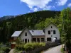
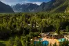
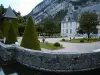
Sassenage is a small town located on the outskirts of Grenoble city. Village, Sassenage knew, over time, preserve its heritage and landscape of the expansion of its high Grenoble sister. Nestled at the foot of a cliff, is Sassenage greenery and tranquility. Its various parks and its proximity to the Regional Natural Park of Vercors promises are a variety of walks and hikes, which will introduce you to turn flora, fauna and beautiful landscapes of the region.

Between History and Stories ...

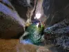
The common Sassenage owes its name to the powerful family who ruled from the 11th century on the territory of the Dauphiné, as well as some of the Vercors the Berenger-Sassenage family. Beside the power and fame, it is said that this family would have ancestor Fairy Melusine, whose legend is attached to the cave tanks Sassenage.

In the 19th century, Sassenage is a thriving village located on the only road leading into the Vercors, in fact it attracts many visitors came to learn and seek the cool walks along the Furon. There are among them many romantic poets and writers, who, like Stendhal, come to seek inspiration from the enchanting nature.

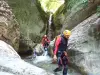
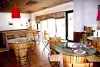
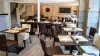
Exploring the cave tanks and setting up tours, in 1865, then drains a large flow of curious. This contributes to the tourism and economic prosperity of the city, which is also, at that time, a mecca of gastronomy. Many restaurants populated indeed common, and offered their customers local products and specialties of the area, such as the famous Bleu du Vercors-Sassenage. One of these restaurants opened by the famous master chef Claude-Joseph Rostang in 1950, became in 1951 one of the most prestigious restaurants in France, obtaining its first Michelin star, and attracting many celebrities of the period.

Geographical information

MunicipalitySassenage
Postcode38360
Tourism label
Latitude45.2066460 (N 45° 12’ 24”)
Longitude5.6636780 (E 5° 39’ 49”)
AltitudeFrom 199m to 1409m
Surface area13.31 km²
Population11545 inhabitants
Density867 inhabitants/km²
PrefectureGrenoble (8.5 km, 14 min)
Insee code38474
IntercommunalityME Grenoble-Alpes-Métropole
DepartmentIsère
TerritoriesAlps, Dauphiné
RegionAuvergne-Rhône-Alps

Nearest cities & towns

Fontaine2.9 km (7 min)
Seyssinet-Pariset4.1 km (8 min)
Seyssins6.4 km (13 min)
Saint-Égrève7 km (12 min)
Fontanil-Cornillon7.3 km (14 min)
Saint-Martin-le-Vinoux7.8 km (11 min)
Grenoble8.6 km (12 min)
Veurey-Voroize9.1 km (14 min)
La Tronche10.1 km (15 min)
Échirolles10.3 km (16 min)
Proveysieux11.2 km (20 min)
Noyarey11.5 km (26 min)
Quaix-en-Chartreuse12.6 km (22 min)
Mont-Saint-Martin12.7 km (26 min)
Voreppe13.2 km (14 min)

Things to see and do

Places of interest

Information points
Monuments
Performance halls

Events and festivities

Photos

Castle Sassenage
Castle Sassenage
See photo
Cave the tanks - concretion Witch
See photo
Park and lake of rugby
See photo
Washtub
Washtub
See photo
St. Pierre
St. Pierre
See photo
Cave the tanks Sassenage
See photo

Weather

Monday 20 may
Min. 10°C - Max. 21°C
Day
Night
Tuesday 21 may
Min. 12°C - Max. 17°C
Day
Night
Wednesday 22 may
Min. 11°C - Max. 16°C
Day
Night

Visits, leisure and activities nearby

Leisure activities

Last nameActivity typeRateCity
Canyoning around Grenoble, Chartreuse and Vercors
Sports sensations48 € to 60 € Grenoble (4.5 km)
Canyoning in the heart of Chartreuse and Vercors
Sports sensations50 € to 80 € Grenoble (5.2 km)
Canyoning in Vercors or Chartreuse
Sports sensations50 € to 75 € Grenoble (5.2 km)
Caving in Vercors & Chartreuse
Sports sensations45 € to 75 € Autrans-Méaudre en Vercors (10.1 km)
Outdoor show: 1944. Resistance! Vercors
Culture and education17 € Pont-en-Royans (30 km)

Outings

Last nameOuting typeDifficultyDurationDeparture municipality
Molière Plateau
HikeIntermediate4:00Lans-en-Vercors (6.5 km)
Vizille panoramic viewpoint
HikeIntermediate2:00Vizille (16.9 km)
Robert Lakes
HikeIntermediate1:30Chamrousse (19.5 km)
Pursollet Lake from Gavet
HikeAthletic4:00Livet-et-Gavet (22 km)
Rioupéroux-Chamrousse, vertical route of the Ut4M race
HikeAthletic3:00Livet-et-Gavet (23 km)

Restaurants

Bed & breakfasts

Vacation rentals

Campsites

Hotels

Your holidays
A hotel
A vacation rental
A bed & breakfast
A campsite
A leisure activity
A restaurant
A rental car
A plane ticket
By continuing to browse our site, you are agreeing to the use of cookies to improve your experience and make targeted offers.
Find out more and make settings
Your account