

Favourite
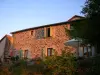
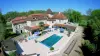
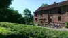
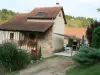
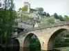
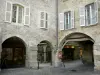
Belcastel
| Municipality | Anglars-Saint-Félix |
|---|---|
| Postcode | 12390 |
| Latitude | 44.4230980 (N 44° 25’ 23”) |
| Longitude | 2.2186849 (E 2° 13’ 7”) |
| Altitude | From 446m to 615m |
| Surface area | 22.22 km² |
| Population | 938 inhabitants |
| Density | 42 inhabitants/km² |
| Prefecture | Rodez (30 km, 32 min) |
| Insee code | 12008 |
| Intercommunality | CC du Pays Rignacois |
| Department | Aveyron |
| Territories | Massif Central, Midi-Pyrénées |
| Region | Occitanie |
| Privezac | 3.4 km (5 min) |
|---|---|
| Lanuéjouls | 5.5 km (6 min) |
| Rignac | 6.5 km (8 min) |
| Vaureilles | 6.9 km (8 min) |
| Prévinquières | 7.6 km (11 min) |
| Roussennac | 7.9 km (8 min) |
| Compolibat | 8 km (11 min) |
| Montbazens | 8.8 km (10 min) |
| Drulhe | 10.7 km (14 min) |
| Brandonnet | 11.3 km (15 min) |
| Lugan | 11.5 km (14 min) |
| Bournazel | 11.6 km (14 min) |
| Valzergues | 11.6 km (13 min) |
| Saint-Igest | 12.3 km (14 min) |
| Last name | Activity type | Rate | City |
|---|---|---|---|
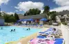
 | Nature and the great outdoors | 20 € | Clairvaux-d'Aveyron (15.4 km) |
 | Local flavours | 7 € to 12 € | Limogne-en-Quercy (36 km) |
| Last name | Outing type | Difficulty | Duration | Departure municipality |
|---|---|---|---|---|
 | Hike | Easy | 1:30 | Capdenac-Gare (18.7 km) |
| Hike | Easy | 2:30 | Tayrac (25 km) |
| Hike | Easy | 2:00 | Figeac (25 km) |
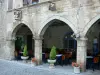
 | Village visit | Easy | 3:00 | Bor-et-Bar (27 km) |
 | Hike | Intermediate | 1:45 | Espeyrac (31 km) |