


Favourite
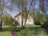
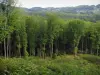
The Chabrières forest
| Municipality | La Chapelle-Taillefert |
|---|---|
| Postcode | 23000 |
| Latitude | 46.1000439 (N 46° 6’ 0”) |
| Longitude | 1.8381720 (E 1° 50’ 17”) |
| Altitude | From 462m to 690m |
| Surface area | 14.11 km² |
| Population | 445 inhabitants |
| Density | 31 inhabitants/km² |
| Prefecture | Guéret (9.3 km, 13 min) |
| Insee code | 23052 |
| Intercommunality | CA du Grand Guéret |
| Department | Creuse |
| Territories | Limousin, Massif Central |
| Region | New-Aquitaine |
| Saint-Christophe | 2.1 km (5 min) |
|---|---|
| Saint-Victor-en-Marche | 3.4 km (7 min) |
| Saint-Éloi | 4.2 km (7 min) |
| Savennes | 4.8 km (9 min) |
| Peyrabout | 7.1 km (13 min) |
| Saint-Léger-le-Guérétois | 7.8 km (13 min) |
| Sardent | 8.9 km (11 min) |
| Guéret | 9.3 km (13 min) |
| Saint-Yrieix-les-Bois | 10.1 km (17 min) |
| Sainte-Feyre | 10.5 km (16 min) |
| Azat-Châtenet | 10.8 km (16 min) |
| Maisonnisses | 10.9 km (16 min) |
| Lépinas | 11.2 km (17 min) |
| Montaigut-le-Blanc | 11.7 km (18 min) |
| Last name | Outing type | Difficulty | Duration | Departure municipality |
|---|---|---|---|---|
 | Village visit | Easy | 3:00 | Soubrebost (15.8 km) |
 | Car itinerary | Easy | 1:00 | Ahun (16.1 km) |
 | Hike | Easy | 1:30 | Bourganeuf (17.4 km) |
 | Village visit | Athletic | 6:00 | Peyrat-le-Château (33 km) |
 | Hike | Easy | 4:00 | Saint-Léger-la-Montagne (33 km) |