Favourite
Serres
| Municipality | Saint-Auban-d'Oze |
|---|---|
| Postcode | 05400 |
| Latitude | 44.4960040 (N 44° 29’ 46”) |
| Longitude | 5.8476100 (E 5° 50’ 51”) |
| Altitude | From 848m to 1603m |
| Surface area | 13.21 km² |
| Population | 81 inhabitants |
| Density | 6 inhabitants/km² |
| Prefecture | Gap (32 km, 34 min) |
| Insee code | 05131 |
| Intercommunality | CC Buëch-Dévoluy |
| Department | Hautes-Alpes |
| Territories | Alps, Dauphiné |
| Region | Provence-Alps-French Riviera |
| Châteauneuf-d'Oze | 3.1 km (6 min) |
|---|---|
| Le Saix | 3.9 km (7 min) |
| Oze | 6.3 km (14 min) |
| Chabestan | 7.4 km (13 min) |
| Veynes | 9.8 km (17 min) |
| Furmeyer | 12.1 km (20 min) |
| La Bâtie-Montsaléon | 13.1 km (21 min) |
| Aspremont | 13.2 km (22 min) |
| Aspres-sur-Buëch | 14.1 km (21 min) |
| Esparron | 14.2 km (22 min) |
| Savournon | 15.1 km (24 min) |
| Montmaur | 16.2 km (22 min) |
| Saint-Pierre-d'Argençon | 17 km (25 min) |
| Barcillonnette | 17.3 km (26 min) |
| Last name | Activity type | Rate | City |
|---|---|---|---|
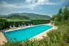
 | Nature and the great outdoors | 200 € to 1100 € | Ancelle (32 km) |
 | Nature and the great outdoors | 55 € to 375 € | Éourres (34 km) |
 | Local flavours | Free | Noyers-sur-Jabron (37 km) |
 | Arts and Crafts | 30 € | Saint-Vincent-sur-Jabron (37 km) |
 | Sports sensations | 44 € | Ubaye-Serre-Ponçon (41 km) |
| Last name | Outing type | Difficulty | Duration | Departure municipality |
|---|---|---|---|---|
 | Hike | Intermediate | 2:15 | La Faurie (11.7 km) |
 | Hike | Easy | 3:00 | La Bâtie-Vieille (26 km) |
 | Hike | Intermediate | 5:00 | La Bâtie-Vieille (26 km) |
 | Hike | Easy | 3:00 | Saint-Laurent-du-Cros (26 km) |
 | Hike | Athletic | 3:00 | Ancelle (32 km) |