Liven up your holidays!

Colombiès

Tourism, holidays & weekends guide in the Aveyron

Colombiès - Tourism, holidays & weekends guide in the Aveyron
7.2
4

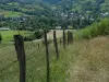
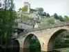
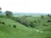
Bounded on the north by the Aveyron valley and south by the 911 county, the municipality of Colombiès covers 5523 ha. Four former parishes, Combrouze, Limayrac, Talespues in addition to Colombiès make up the town. Now populated by almost 1,000 inhabitants, the town had up to 2,317 inhabitants in the census of 1895, distributed in many hamlets and villages, showing the vitality of the town of Ségala which then included 22 flour mills and the oil spread over the different maresques, Aveyron tributaries carve a schistose plateau 700 meters above sea level.

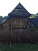
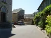
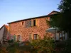
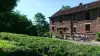
The village of Colombiès, formerly Colombier, includes many traditional houses with exterior stairs, closed courses, doors and windows marked the fifteenth and sixteenth century.

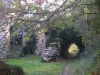
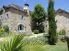
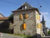
The municipality has several castles and monastic barns that depended on the abbey of Loc-Dieu: Mazet of the castle, mansion dating from 1750, which was the property of Baron de Balsac and Périé castle, construction of Saunhac -Belcastel, Jules property Bonhomme (1811-1867) active agronomist in the use of new techniques.

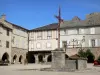
After the contribution of lime on the Ségala, the sixties saw a great development of agricultural production leading to some of the common vitality which was accompanied by many collective investments in the service of the population: sports fields, bowling (iconic sports of the municipality with 200 licensees, school bowling, football...), activity rooms, management of municipal buildings into rental units, creation of subdivisions...

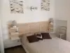
Today improving traditional housing, new housing construction, development of hospitality in guest rooms, the presence of a school of nearly 50 children, the proximity of towns as centers Baraqueville, Rieupeyroux or Rignac, the arrival of the National 88-4 channels are assets to come live this beautiful rural town of Rouergue.

Geographical information

MunicipalityColombiès
Postcode12240
Latitude44.3458450 (N 44° 20’ 45”)
Longitude2.3399840 (E 2° 20’ 24”)
AltitudeFrom 390m to 751m
Surface area55.23 km²
Population899 inhabitants
Density16 inhabitants/km²
PrefectureRodez (31 km, 34 min)
Insee code12068
IntercommunalityCC Pays Ségali Communauté
DepartmentAveyron
TerritoriesMassif Central, Midi-Pyrénées
RegionOccitanie

Nearest cities & towns

Belcastel10.4 km (15 min)
Boussac10.9 km (15 min)
Castanet11 km (13 min)
Rieupeyroux12.6 km (14 min)
Rignac13 km (19 min)
Baraqueville13.1 km (13 min)
Gramond15 km (21 min)
Mayran15.5 km (22 min)
Sauveterre-de-Rouergue17 km (22 min)
Pradinas17.1 km (17 min)
Manhac19.2 km (21 min)
Camboulazet19.4 km (22 min)
Anglars-Saint-Félix19.8 km (23 min)
Roussennac19.8 km (24 min)

Photos

Landscape of Ségala
Landscape of Ségala
See photo
Le Segala, 100 countries valleys
See photo
Limousine
Limousine
See photo
Deer
Deer
See photo
Hiking along the water
See photo
Ségala Vane
Ségala Vane
See photo
Barn
Barn
See photo
Veal from the Aveyron and Ségala, red label
See photo

Weather

Sunday 19 may
Min. 8°C - Max. 19°C
Day
Night
Monday 20 may
Min. 10°C - Max. 15°C
Day
Night
Tuesday 21 may
Min. 10°C - Max. 12°C
Day
Night

Visits, leisure and activities nearby

In the center of beautiful and natural attractions

Valley of Aveyron: Belcastel, ranked among the most beautiful villages in France (15 minutes).

Plateau Ségala: Sauveterre-de-Rouergue, ranked among the most beautiful villages in France (20 minutes), Lake Baraqueville (10 minutes), Animal Park of Pradinas (15 minutes), fortified church Boussac (10 minutes), Soulages museum and Cathedral of Rodez (25 minutes).

Leisure activities

Last nameActivity typeRateCity
Botanical walk and plant workshop
Nature and the great outdoors20 € Clairvaux-d'Aveyron (10.7 km)
Discover truffles
Local flavours7 € to 12 € Limogne-en-Quercy (46 km)
Barge trip in Albi and on the Tarn
Entertainment7 € to 25 € Albi (49 km)

Outings

Last nameOuting typeDifficultyDurationDeparture municipality
Municipality of Tayrac: from the plateau to the valley
HikeEasy2:30Tayrac (18.1 km)
Laurélie, Bor and Bar
Village visitEasy3:00Bor-et-Bar (27 km)
Around Malepeyre
HikeEasy1:30Capdenac-Gare (32 km)
Walking tour 13 from Espeyrac
HikeIntermediate2:10Espeyrac (32 km)
Walking tour No.11 from Espeyrac
HikeIntermediate1:45Espeyrac (33 km)

Restaurants

Bed & breakfasts

Vacation rentals

Campsites

Hotels

Your holidays
A hotel
A vacation rental
A bed & breakfast
A campsite
A leisure activity
A restaurant
A rental car
A plane ticket
By continuing to browse our site, you are agreeing to the use of cookies to improve your experience and make targeted offers.
Find out more and make settings
Your account